CALEDONGEOSPATIALLet’s map your project ↗
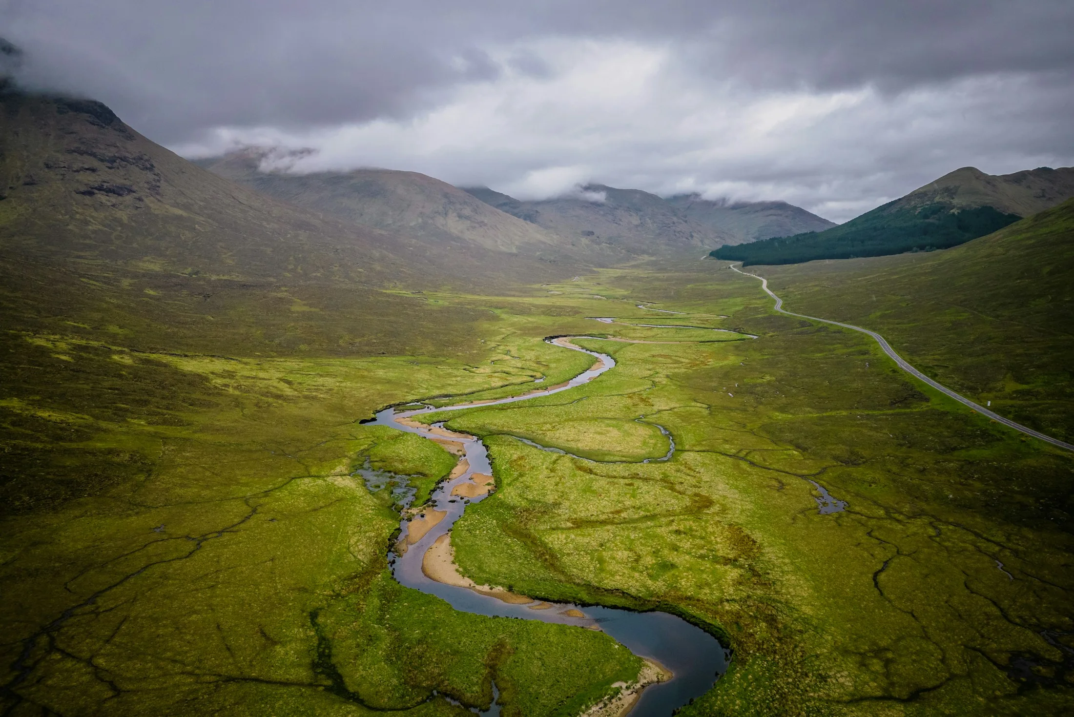
A winding river through a green Scottish Highland valley

A NEW PERSPECTIVE. GROUNDED IN SCOTLAND.

A clearer view
of your land.

Drone mapping and geospatial insight for the places you build, manage and restore.

Explore our capabilities ↘
LAND. DEVELOPMENT. RESTORATION.⊕ SCOTLAND, UNITED KINGDOMSCROLL TO EXPLORE ↓
RGB PHOTOGRAMMETRY✳ORTHOMOSAIC MAPPING✳3D SURFACE MODELS✳REPEAT MONITORING

01 / THE BIGGER PICTURE

Good decisions start
with a better perspective.

From a construction site taking shape to a landscape being restored, knowing what’s on the ground makes all the difference. We turn aerial imagery into clear maps, measurable surfaces and useful project records.

A focused geospatial service for Scotland’s land and development projects.

02 / WHAT WE DO

From capture
to clarity.

Three focused services.
Built around what your project needs.

01

Mapping &
photogrammetry

Understand your site with detailed aerial mapping, point clouds and 3D surface models, prepared to an agreed specification.

  • Orthomosaics & site baselines
  • Point clouds & surface models
  • GIS-ready project outputs
Discuss a mapping project ↗
02

Progress &
change monitoring

Keep a consistent record of your site as it evolves. Compare visits, review visible changes and track agreed quantities.

  • Scheduled progress surveys
  • Stockpile volume measurements
  • Before & after comparisons
Plan repeat monitoring ↗
03

Land &
restoration support

Document landscapes before, during and after works. Give your land-management team a detailed, shared view of the site.

  • Restoration baseline imagery
  • Visible feature & works mapping
  • Follow-up aerial records
Explore land mapping ↗
WORKING WITH YOUR TEAM

Capture and processing support for surveyors, environmental consultants, contractors and land managers.

03 / THE DELIVERABLES

More than imagery.
Information you can use.

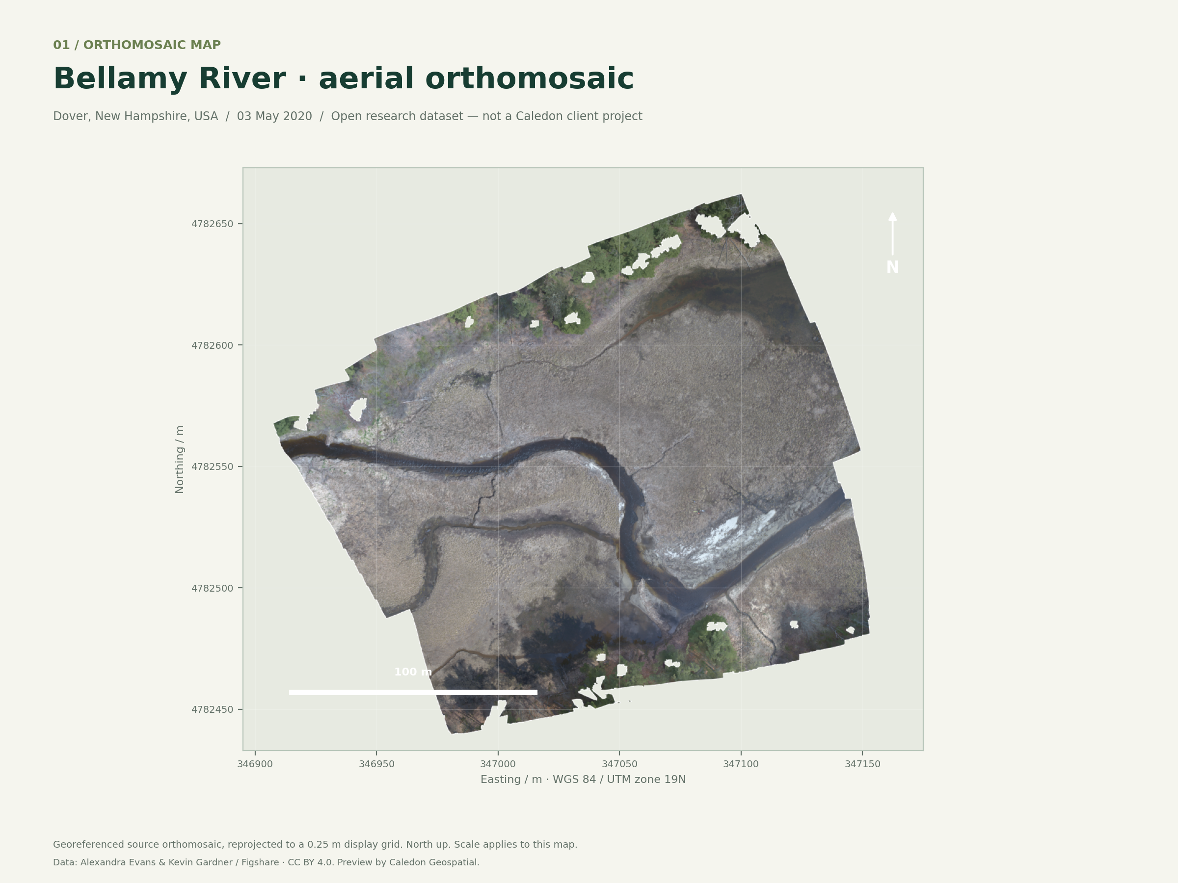
Explore real orthomosaic and surface-model data, plus a two-date comparison prepared from an open research survey. Each example includes its source and method.

SURVEY OUTPUT EXAMPLESOPEN RESEARCH DATA

A genuine, georeferenced orthomosaic.

Bellamy River, USA · 03 May 2020. An actual drone-derived map with a coordinate grid, north arrow and scale bar.

ORTHOMOSAIC

Data: Alexandra Evans & Kevin Gardner · 2020 survey ↗ · 2019 survey ↗ · CC BY 4.0. Rendered and analysed by Caledon Geospatial. These examples are from New Hampshire, USA, and are not Caledon client projects. Sources & method ↗

04 / OUR APPROACH

Care in every flight.
Clarity in every file.

A straightforward process,
from your first brief to your final handover.

01 / DEFINE

Start with the question.

We discuss your site, the decision you need to make and the outputs your team will use.

02 / CAPTURE

Plan the right survey.

Capture is planned around the site, access, airspace, weather and agreed quality requirements.

03 / PROCESS

Build a useful dataset.

Imagery is processed and checked, with the method and limitations documented for your project.

04 / DELIVER

Make the next step clear.

Receive organised files, a clear handover and an explanation of what the outputs show.

⊕
Built on a capable foundation.

DJI Matrice 4E · RGB aerial capture · Photogrammetric processing

Multispectral requirements are scoped separately. Specialist ecological and engineering interpretation is agreed with your project team.

A FEW USEFUL DETAILS

Before we take flight.

What can you deliver?+

Depending on the brief: orthomosaic maps, photogrammetric point clouds, 3D surface models, volume reports and repeat-visit comparisons. File formats and coordinate systems are agreed before work starts.

How accurate will my survey be?+

Accuracy depends on the site, flight design, control and verification method. We agree the required accuracy before quoting and document the achieved checks. Image resolution alone is not an accuracy guarantee.

Can you provide multispectral data?+

Multispectral capture requires a different sensor from the RGB cameras on our Matrice 4E. Tell us the bands, application and interpretation you need so that suitable additional equipment or specialist support can be scoped.

Where do you work, and how long does it take?+

Our initial focus is Scotland. Site location, access, permissions, weather, survey size and processing requirements determine availability and delivery. A project-specific programme is agreed with the scope.

05 / YOUR NEXT PROJECT

Let’s put your
project on the map.

Tell us a little about your site and what you need to understand.

↗

Prepare a project brief below. Download or copy it, ready to share when contacting Caledon Geospatial.

First-look website · Direct enquiry submission will be available at launch.

Your information stays in this browser. This form prepares a brief; it does not send an enquiry.

SURVEY OUTPUT EXAMPLE

Orthomosaic map

Full-resolution orthomosaic map

Data by Alexandra Evans & Kevin Gardner, CC BY 4.0. Research dataset from the Bellamy River, USA. Not a Caledon client survey.

Download full-resolution PNG ↓

PRIVACY

A simple first-look site.

This website does not use analytics or advertising cookies. The project brief builder processes your entries within your browser and does not submit them to Caledon Geospatial. Downloaded briefs are saved to your device. The copy button uses your clipboard only when selected.

Site hosting may process technical request information to operate the website. External photography credit links take you to Unsplash, which has its own privacy policy.